
Scattered rains are likely in Maharashtra in coming weeks.
Highlights:
- Rainfall forecast in Vidarbha, Marathwada & Central Maharashtra
- Heavy heat wave to continue
- Temperature is likely to go up around 40 degrees.
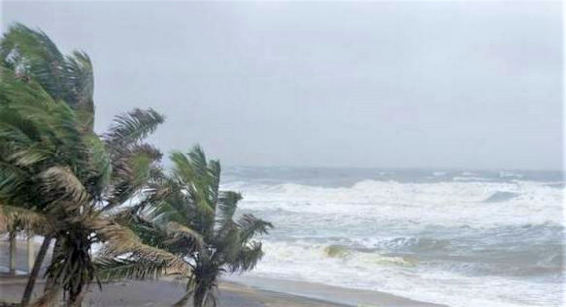
When India and entire world is reeling under hidden virus Covid 19, there is another threat has announced. The Indian meteorological department informed that the first cyclone of the year, 2020 is likely to hit the Bay of Bengal around May 1, 2020.
A private meteorological agency said that the storm is likely to form in the Bay of Bengal and the Andaman Sea and move towards neighbouring countries Myanmar and Bangladesh. So, in the next two-three days in Maharashtra, the temperature is likely to go up around 40 degrees.
Despite the high temperatures, the meteorological department has forecast rains in Virdabha, Marathwada and central Maharashtra. Scattered rains are likely in Maharashtra in the coming weeks.
As per skymet weather, the track of these cyclones is governed by the high-level winds in the area, commonly called steering current. This current will bring the storm to the South-Central parts of the Bay of Bengal. Thereafter, with the approach of a deep westerly trough and prevailing steering current, the cyclone could take a course of re-curvature. The system is expected to intensify to a Severe Cyclonic Storm. The storm will gain strength further and head for Myanmar – Bangladesh coast. It is too early to preempt its landfall, but the coastline from Yangon (Myanmar) to Chittagong (Bangladesh) remains vulnerable

Editor in Chief : Mewati SItaram